Living in Weston MA: Estates, Trails and Commute Perks
February 19, 2026
February 19, 2026
Imagine waking up to birdsong, stepping onto a wooded trail before work, and still making it to your Boston office in about a half hour on a typical day. If you’re drawn to space, privacy, and easy access to the city, Weston might be exactly what you’re picturing. In this guide, you’ll get a clear look at Weston's estate-scale living, its extensive trail network, and your real commute options. You’ll also find practical tips on zoning, septic systems, and schools so you can decide if Weston fits your lifestyle. Let’s dive in.
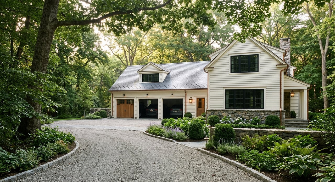
Weston sits roughly 12 miles west of Boston in Middlesex County and covers about 17 square miles of largely residential land. The 2020 Census counted 11,851 residents, with recent estimates showing a similar population level. You’ll notice a low-density pattern almost everywhere, from tree-lined roads to deep front setbacks and long driveways. For a quick orientation, see the town’s overview of local geography and road access on the official Geography & Statistics page and population details in the U.S. Census QuickFacts.
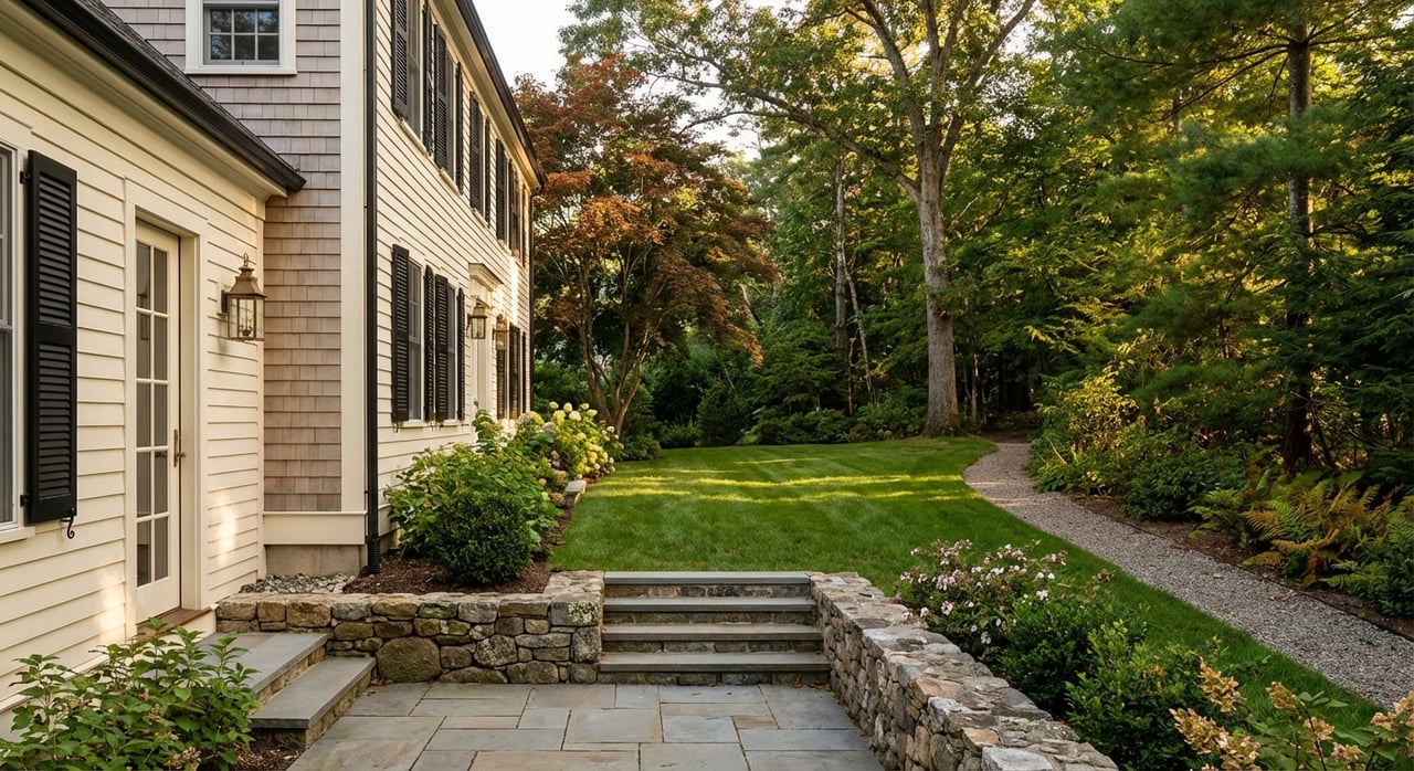
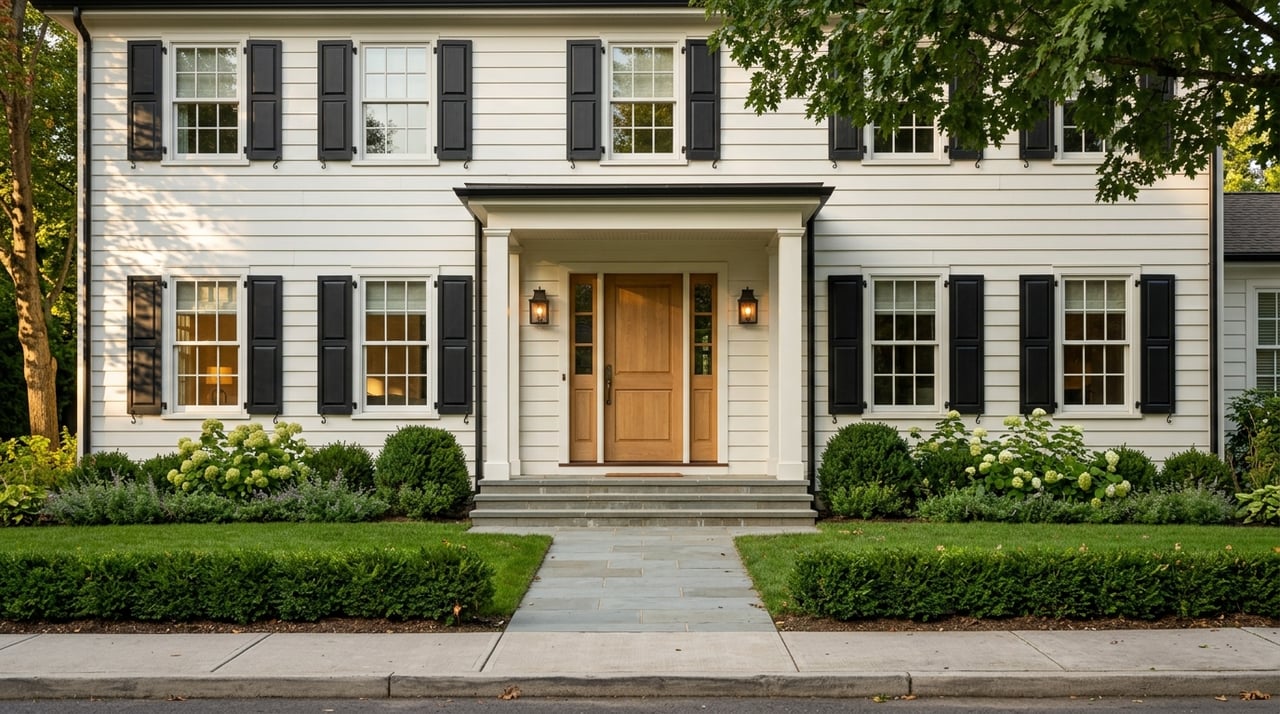
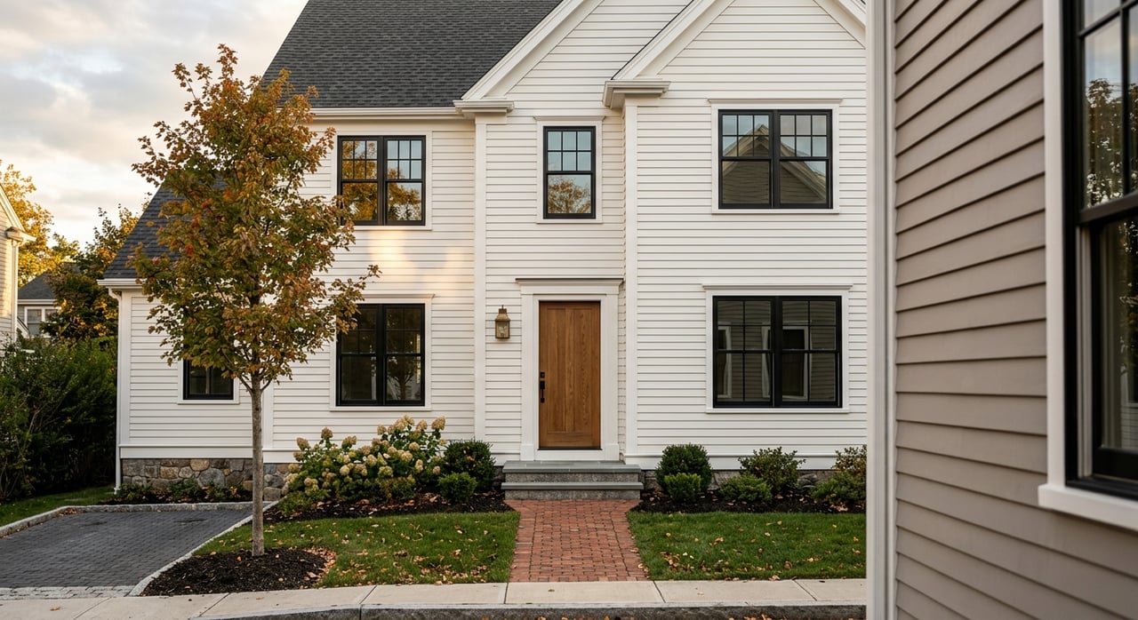
Most of Weston is zoned for single-family homes on large lots. The town’s four districts set minimum lot sizes at 60,000, 40,000, 30,000, and 20,000 square feet. Those requirements, along with frontage and setback rules, limit subdivision density and help maintain a quiet, private feel across neighborhoods. You can see the exact dimensions by district on the town’s Zoning Requirements page.
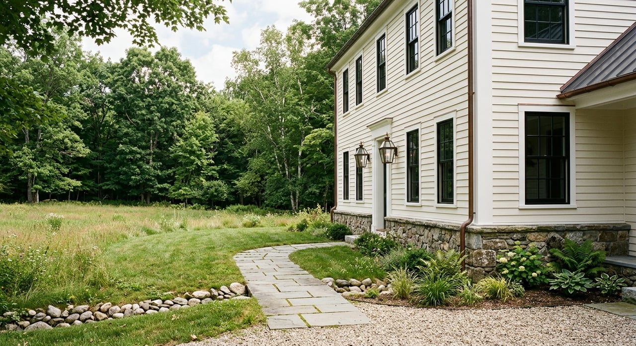
Designated scenic roads also shape the look and pace of daily life. These roads protect stone walls, mature trees, and historic character, which keeps many streets visually open and calm. If you’re considering improvements or driveway changes, review the official Scenic Roads map to understand local protections.
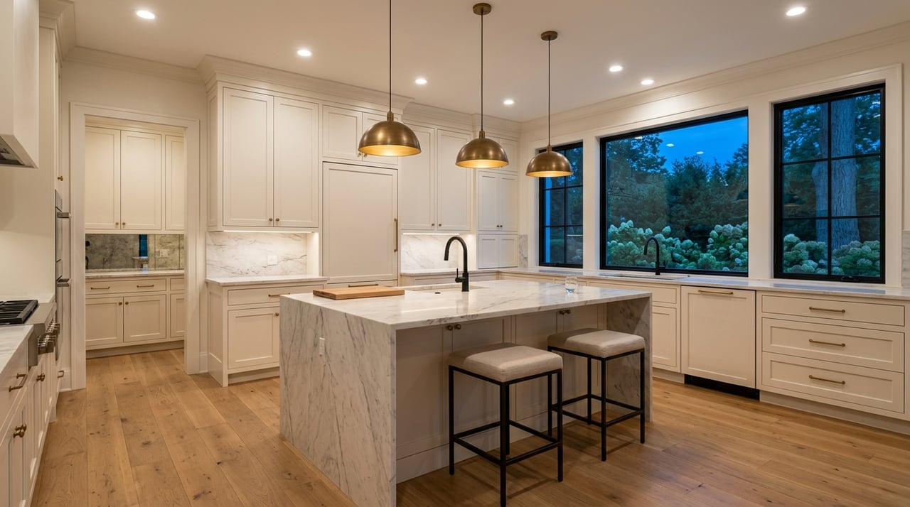
Home values in Weston often sit in the low-to-mid millions, with recent medians commonly appearing in the roughly 1.7 to 2.4 million dollar range depending on the data source and time window. Month-to-month numbers can move quickly because the town sees relatively few sales, and the occasional multi-acre estate can skew short-term medians. If you are planning a purchase or sale, it’s smart to review data for the exact month and property type you care about and to confirm the current picture in MLS on your timeline.
Weston’s low-key, rural feel is not an accident. The town points to about 2,000 acres of conserved land and around 90 miles of trails that link neighborhoods to woods, fields, and reservoirs. This network blends municipal land, nonprofit stewardship, and private conservation restrictions. For a high-level summary, review the town’s open space FAQ. If you like to plan hikes or runs, the Weston Forest & Trail Association maintains excellent maps and parcel guides for everyday use.
From the College Conservation Area and Jericho Town Forest to Sears Land and the reservoir properties, there are trailheads near many residential areas. That means you can often fit a quick loop into your morning or head out for a longer weekend walk without getting in the car. The town is also updating its Open Space & Recreation Plan, with a focus on better connectivity and year-round access, which you can track in this OSRP planning update.
Scenic-road designations help protect the tree canopy and historic roadside elements. They also support the visual calm that many Weston buyers value. If you are evaluating a specific street, the official Scenic Roads map is your best reference.
The Massachusetts Turnpike crosses the southern side of town, while I‑95/Route 128 runs along the east. This setup gives you straightforward access to Boston and the inner suburbs. Residents’ average commute time is about 26.6 minutes according to recent Census data, which signals a reasonable baseline for many workers, though peak highway traffic varies. For a quick overview of Weston's placement and road network, see the town’s Geography & Statistics page and the commute-time statistic in Census QuickFacts.
Kendal Green is Weston's MBTA stop on the Fitchburg Line, with inbound trains to North Station. Typical published trips run in the mid‑30 minute range depending on the train, which makes the line appealing if you prefer rail over driving. Check station details and context here: Kendal Green station. Keep in mind that MBTA timetables and station service can change, so confirm current schedules before you plan around rail.
Riverside Station sits just over the Newton line near southeastern Weston and offers frequent Green Line D Branch service into Boston. Many residents drive or bike to Riverside for higher-frequency rapid transit, especially for off-peak trips. For general local context, you can review the Weston overview on Wikipedia.
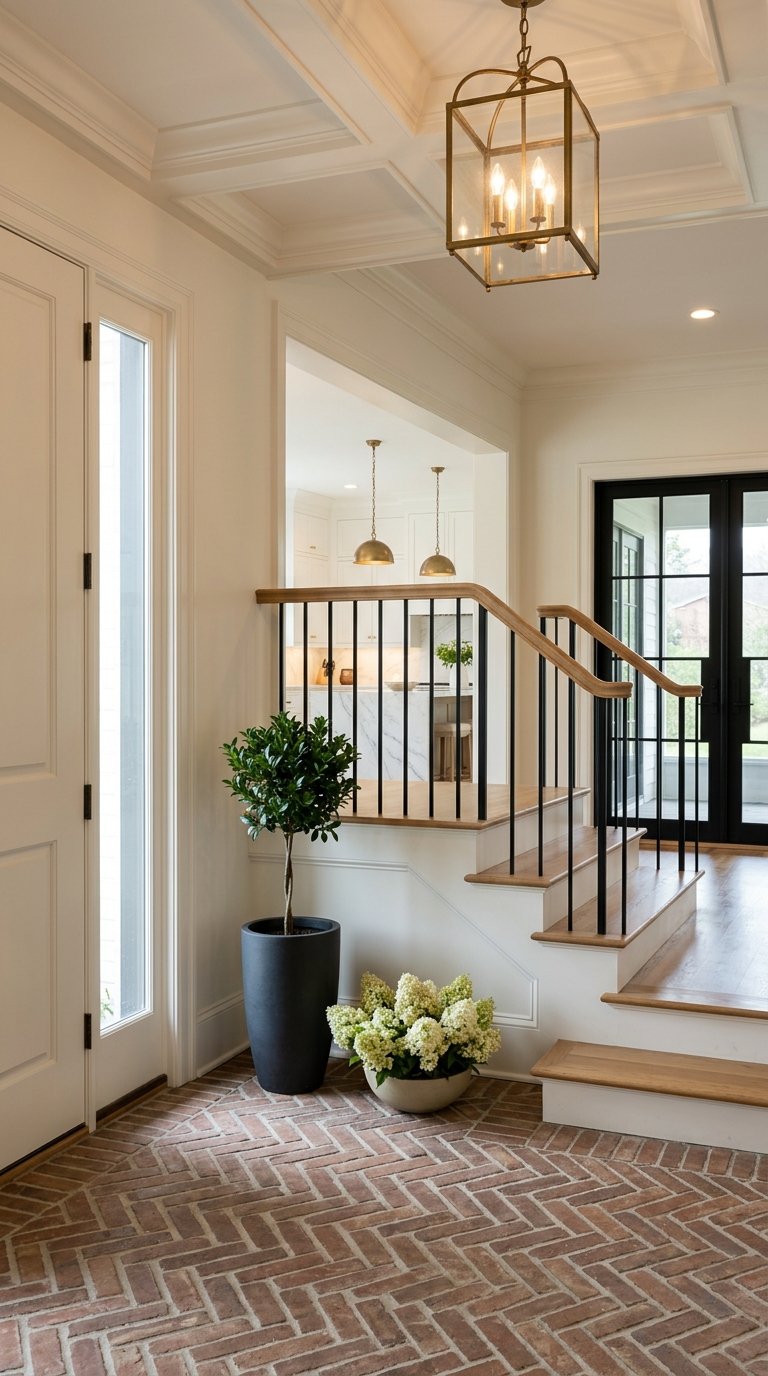
Weston’s compact town center includes the library, town offices, and a cluster of shops and dining options along and near Boston Post Road. You are close to larger retail and services in neighboring Wellesley and Wayland as well. For a sense of how the town is laid out and where facilities sit, explore Weston’s Geography & Statistics and the DPW’s Prepared Maps portal for parks and fields.
Weston Public Schools are known for strong academic outcomes and a small-district feel. Independent summaries frequently place Weston High School among the top performers in Massachusetts. You can review recent rankings on Niche’s Weston High profile and statewide roundups on U.S. News’ Massachusetts high school rankings. Always verify the latest data and any changes to programming or budgets on the district’s site.
If you value privacy, green space, and a straightforward trip to Boston, Weston delivers a rare blend of estate-scale lots, miles of trails, and real commute choices. The market tends to be low inventory and data can shift quickly, so a precise, property-by-property approach is essential.
Thinking about buying or selling in Weston? Let the Power of Three guide your next step with data-backed pricing, white-glove preparation, and local insight. Connect with Beyond Boston Properties to talk strategy or Request a Personalized Home Valuation.
Stay up to date on the latest real estate trends.


Contact us today to discover how the power of three can elevate your home buying and selling experience in the towns and communities of Greater Boston.